Lagos’ oceanfront isn’t a single line—it’s a long, low ribbon of sand and barrier land that separates the Atlantic from a web of lagoons, creeks, and wetlands. Much of the state sits on a predominantly flat coastal plain, with an average elevation reported as under 1.5 m above sea level, and coastal terrain that is literally formed by sandy strips and spits. That geography is beautiful, but it also means Lagos is exposed to wave attack, shoreline retreat, and storm surges that can push saltwater inland.
What this zone is
Think Victoria Island–Lekki–Ibeju-Lekki: a barrier-and-spit system along the Atlantic that is narrow, sandy, and constantly reshaped by longshore drift and storms. Lagos’ coastal strip is described as lagoons/creeks/swamps separated from the open sea by a strip of sandy land (roughly 2–16 km wide).
A key point for designers: barrier landscapes are meant to move. When we “freeze” them with walls everywhere, we often trade today’s stability for tomorrow’s catastrophic failure.
What makes it flood-prone (and why it’s different from inland flooding)
Oceanfront flooding is not just “too much rain.” It’s a mix of:
- Storm surge + wave run-up overtopping beaches and revetments.
- Coastal erosion thinning the protective beach/dune buffer.
- Backflow where rainwater can’t discharge because tides/surge raise water levels at outfalls.
On the Lekki Peninsula specifically, research describes low-lying topography (large areas within a few meters of mean sea level) and models potential storm-surge risk at 4–5 m surge heights, recommending base/design flood elevations for new development.
Design mindset: from “hard line” to layered coastal defence
The most robust approach for Lagos’ oceanfront is a layered defence—a sequence of protections that can each fail gracefully without collapsing the whole system:
- Offshore wave energy reduction
Reefs, breakwaters, or nearshore sills reduce wave height before it hits land—especially valuable where erosion is chronic.
- A sacrificial beach + dune system (“the living levee”)
Wide beaches and planted dunes are not decoration; they’re a dynamic sponge for wave energy.
- Surge parks and floodable coastal open space
Parks designed to accept overtopping and saltwater flooding protect dense districts behind them.
- Raised critical routes + elevated buildings where retreat isn’t possible
Treat roads, transit, power, and hospitals as the “dry backbone,” while allowing certain public spaces to flood.
Key typologies that fit Lagos’ Atlantic front
1) Surge Parks (coastal floodable parks)
Instead of a wall that says “no,” a surge park says: “flood here, not there.” The landscape is shaped as berms, dunes, and swales; paths and plazas are built with salt-tolerant materials; and critical utilities are lifted above surge levels.
Global example: The BIG U / Dryline, New York City (Rebuild by Design) frames flood protection as an inhabitable ribbon—park space + protective edges around low-lying neighbourhoods.
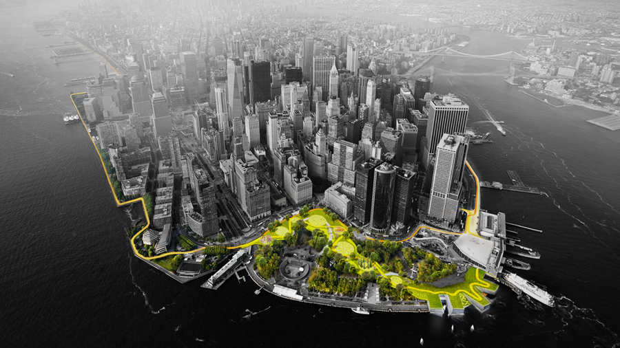
The BIG U, New YOrk City, USA (Source: rebuildbydesign.org)
2) Living Breakwaters / Habitat Reefs
This is coastal engineering that also builds ecology. The goal is wave attenuation and shoreline stabilization, but it’s designed as habitat.
Global example: Living Breakwaters, Staten Island (SCAPE) uses nearshore structures to dissipate wave energy and reduce erosion while creating marine habitat; it’s positioned as layered coastal resilience infrastructure.
3) “Build with nature” nourishment at metropolitan scale
For sandy coasts, one of the most powerful tools is sediment management—put sand where currents can distribute it over time, feeding beaches and dunes.
Global example: The Netherlands’ Sand Motor is a mega-nourishment project that relies on waves, wind, and tides to spread sand along the coast and into dunes to strengthen long-term coastal safety.
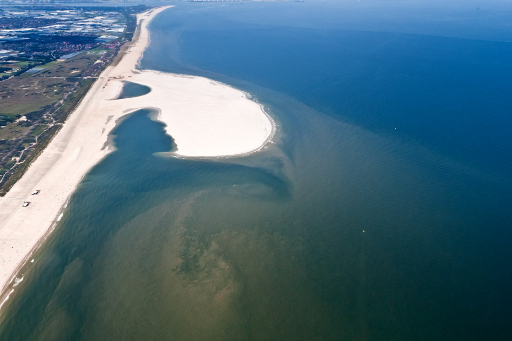
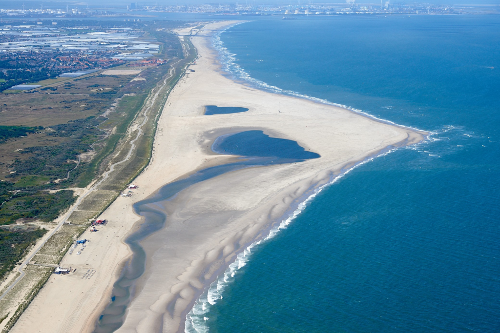
Zandmotor, The Neatherlands (Source: zandmotor.nl)
4) Hybrid seawalls (only where necessary)
Where you truly must hold a line—ports, dense urban frontage—build “hybrid edges”: stepped revetments, terraces, and overtoppable promenades that reduce reflection and create public space.
Lagos already has a prominent hard-defence precedent: the “Great Wall of Lagos” at Eko Atlantic, described by the project as built to protect the shoreline of Victoria Island and early phases of Lekki from coastal erosion and regular Atlantic flooding. The design lesson isn’t “copy it everywhere,” but rather: use hard structure strategically, and avoid pushing risk down-drift or trapping water behind walls without drainage capacity.
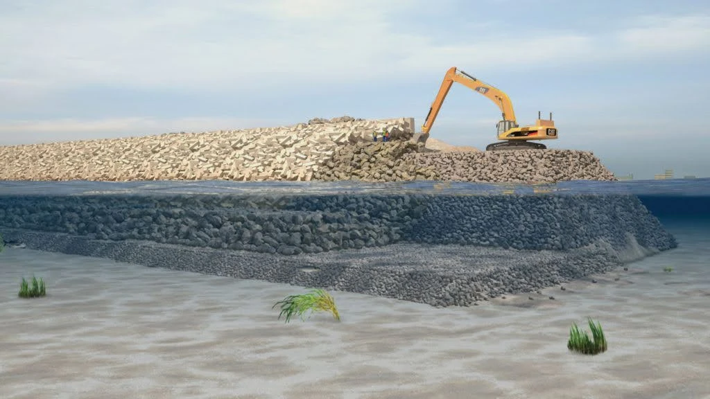
"The Great Wall of Lagos", Eko Atlantic_Lagos, Nigeria (Source: soluap.com)
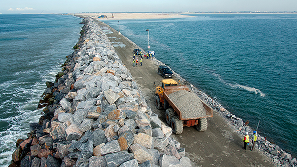
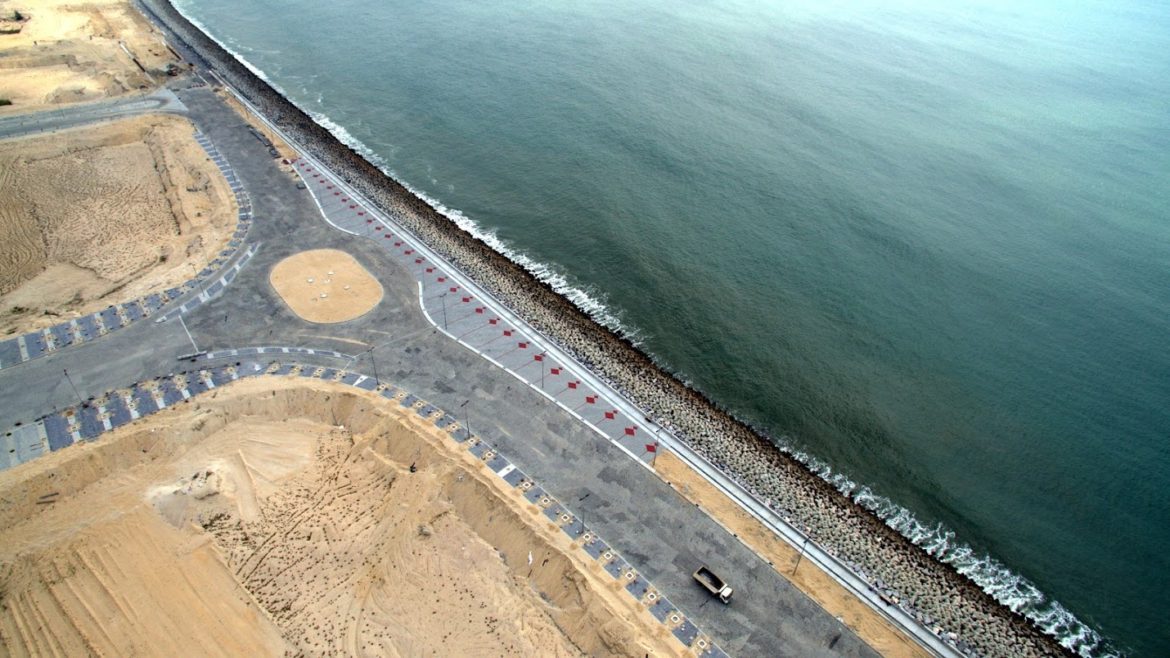
"The Great Wall of Lagos", Eko Atlantic_Lagos, Nigeria (Source: chagourygroup.com & ekoatlantic.com)
What an oceanfront Lagos strategy could look like (design moves)
- Create an “Atlantic Resilience Spine”: a continuous sequence of dunes, surge parks, and elevated promenades that stitches together currently fragmented coastal spaces.
- Codify coastal setbacks + flood elevations for new projects on the barrier landscape, aligned with modelled surge risk and base/design flood elevations.
- Design stormwater outfalls as coastal infrastructure: tide gates/check valves, redundancy, and overflow routes into surge parks (not into streets).
- Pick 2–3 pilot transects (a high-value district, a mixed-income stretch, a more natural reach) and build demonstrators that prove the model socially and economically.
Oceanfront Lagos doesn’t need to become a city behind walls. It can become a city with a thick edge—a public, ecological, floodable landscape that turns the Atlantic boundary into protection and identity.
