Site Analysis & Ecological Mapping
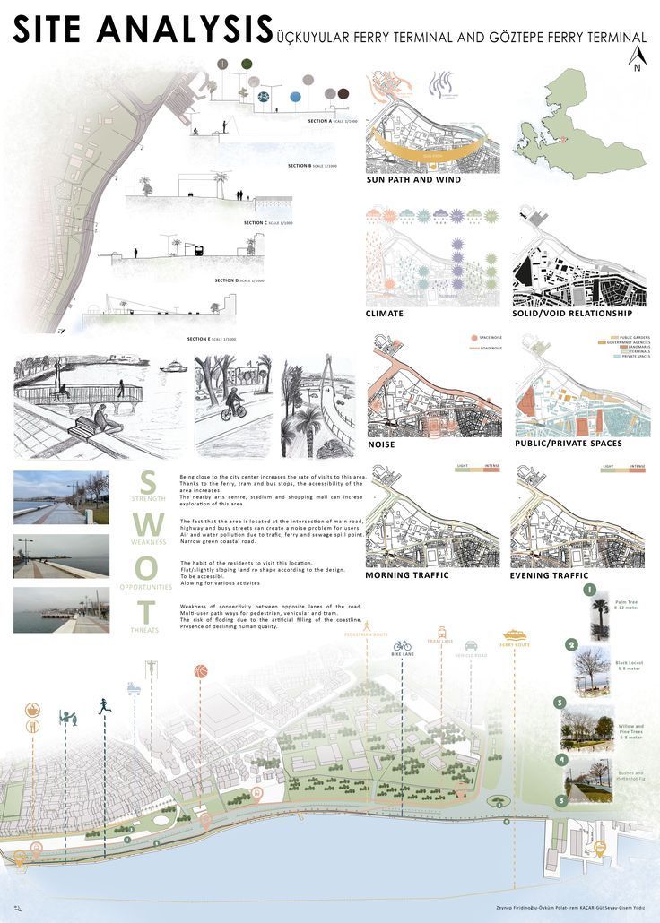
Site analysis (Source: Zeynep Firidinoglu_pinterest.com)
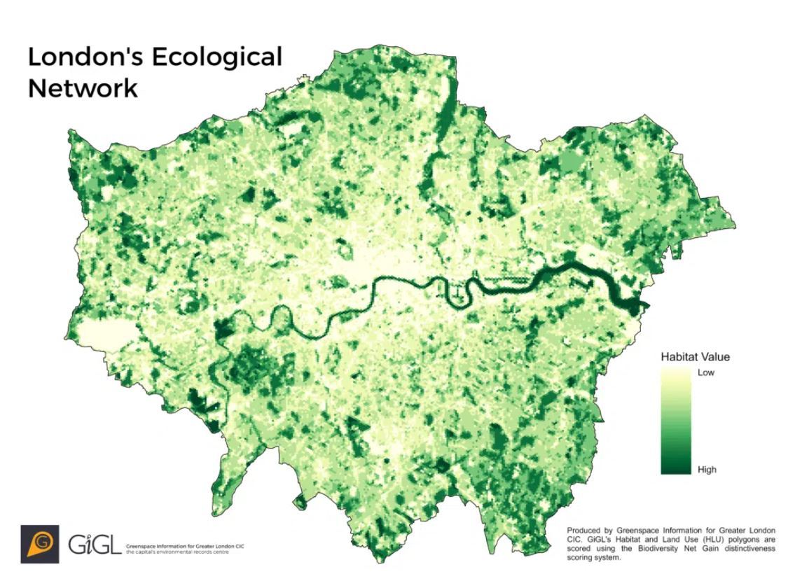
(Source: gigl.org.uk)
Before a single plant is selected or a path laid down, effective coastal resort landscape design must begin with an in-depth understanding of the site’s ecological and geological context. Site analysis and ecological mapping are essential to creating interventions that are sensitive, resilient, and regenerative. This process involves understanding the coastal typologies, conducting biodiversity audits, and integrating advanced geospatial tools to create a holistic baseline of the landscape.
Understanding Coastal Typologies
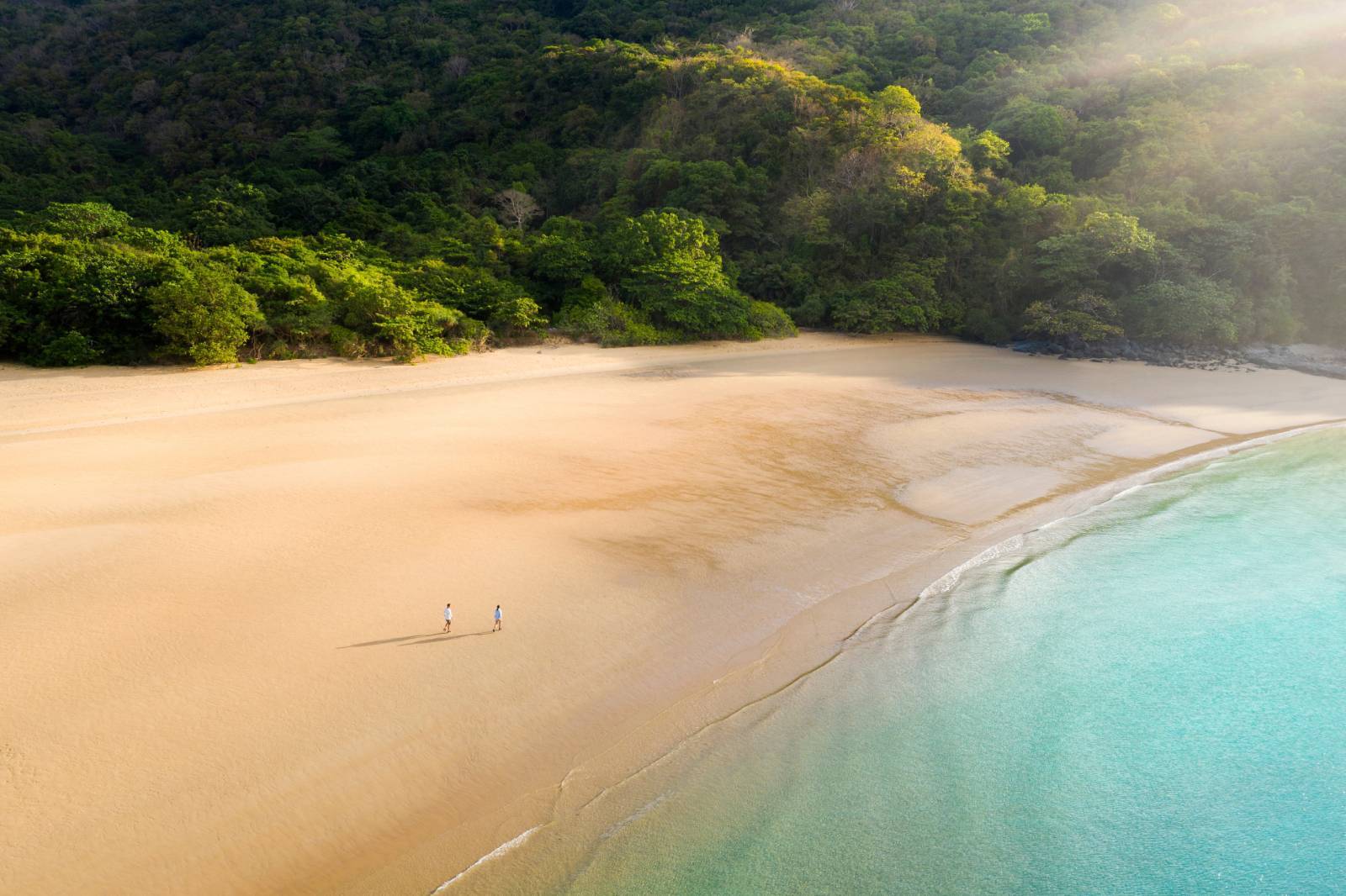
Each coastal site is defined by its unique typology—be it dunes, mangroves, coral reefs, or cliffs—each with specific ecological roles and vulnerabilities:
- Dunes: These are natural barriers that buffer inland ecosystems from storms and rising tides. They support specialized vegetation and often host fragile nesting grounds for species like sea turtles and shorebirds. Mismanagement or removal of dunes can lead to catastrophic erosion and long-term instability.
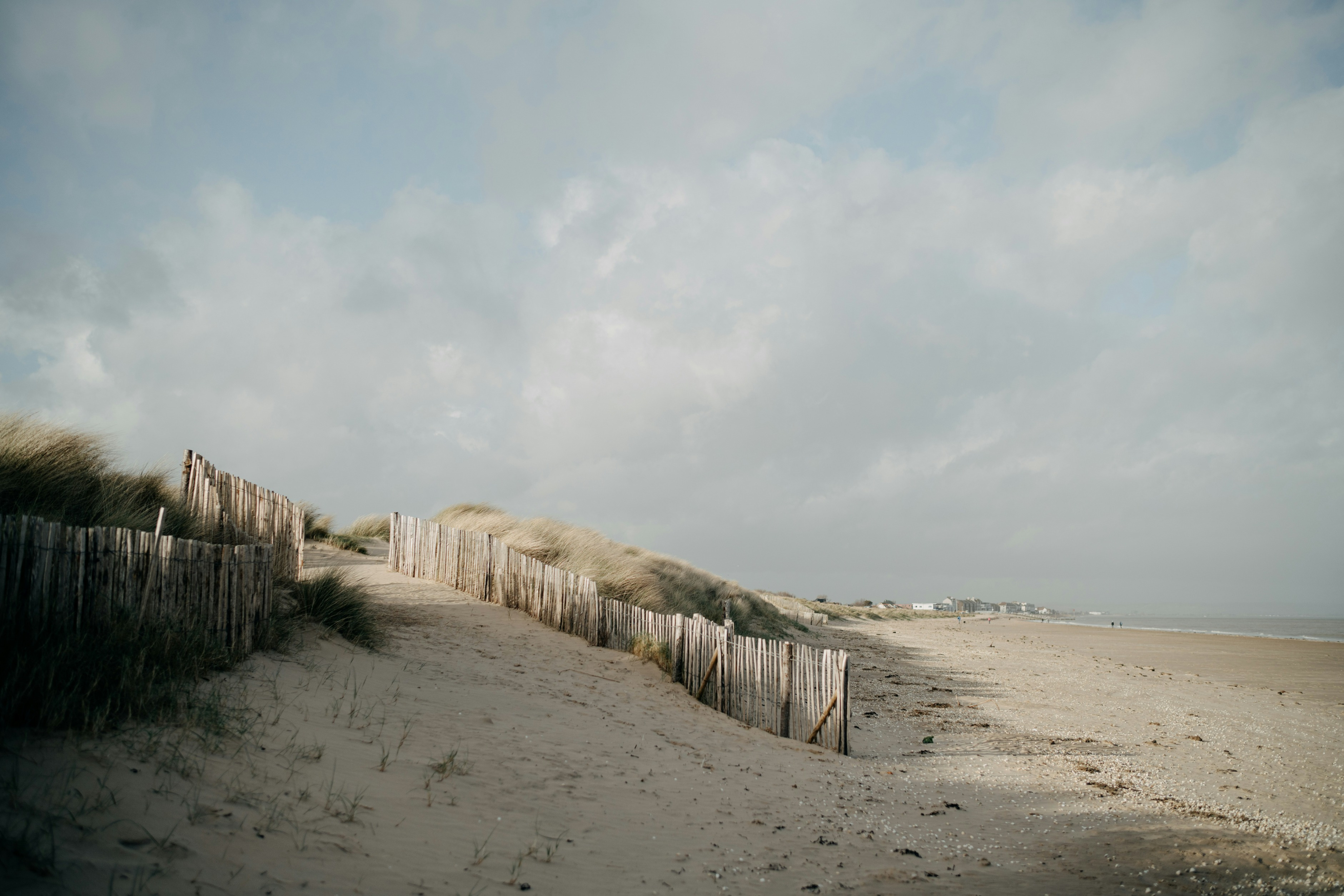
Coastal Dunes (Source: Annie Spratt_unsplash.com)
- Mangroves: Acting as both carbon sinks and biodiversity havens, mangrove forests stabilize coastlines and filter pollutants. Their root systems provide shelter for juvenile fish and protect against storm surge. Mangroves are often undervalued in development planning but are critical to coastal resilience and carbon sequestration.
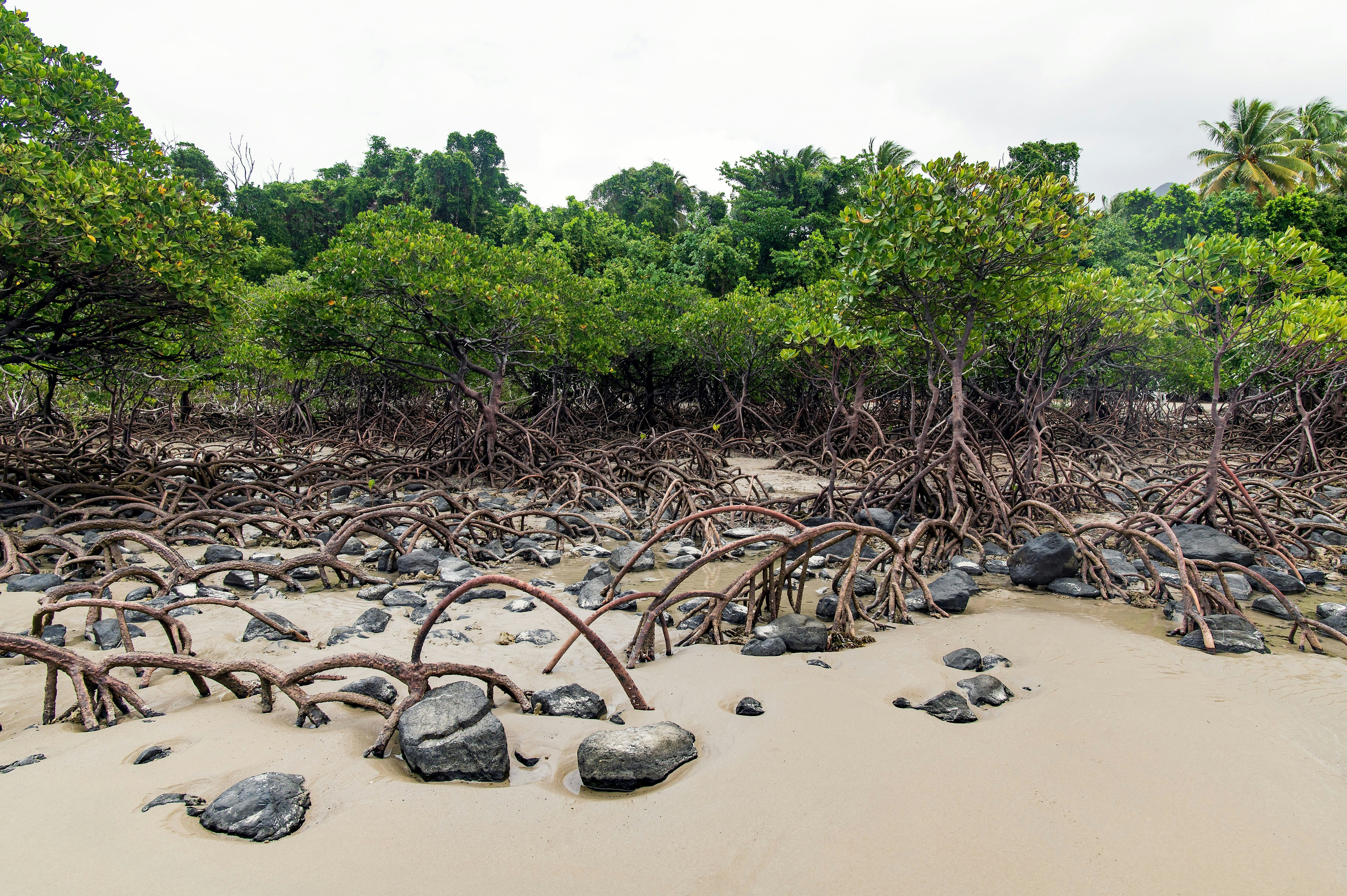
Mangroves (Source: David Clode_unsplash.com)
- Coral Reefs: Coral ecosystems reduce wave energy before it reaches shore, offering both biological richness and physical protection. Coral reefs are sensitive to sedimentation, temperature change, and human traffic, and must be mapped and monitored rigorously when developing in reef-adjacent zones.

Coral reef (Source: Francesco Ungaro_unsplash.com)
- Cliffs: Dramatic and picturesque, coastal cliffs require thoughtful design to prevent erosion and rockfall. Vegetative stabilization, drainage planning, and visual sensitivity are key to safe and ecologically responsible development.

Cliff (Source: Sheng L_unsplash.com)
A 2021 paper in Global Ecology and Conservation underscores that “one-size-fits-all” approaches to these varied landforms can cause greater ecological damage and undermine long-term site integrity (Jones et al., 2021).
Biodiversity Audits: Flora, Fauna, and Habitats
Understanding which species inhabit a landscape is vital to protecting them. A biodiversity audit begins with a catalog of flora and fauna, looking at abundance, seasonality, and spatial distribution. This includes:
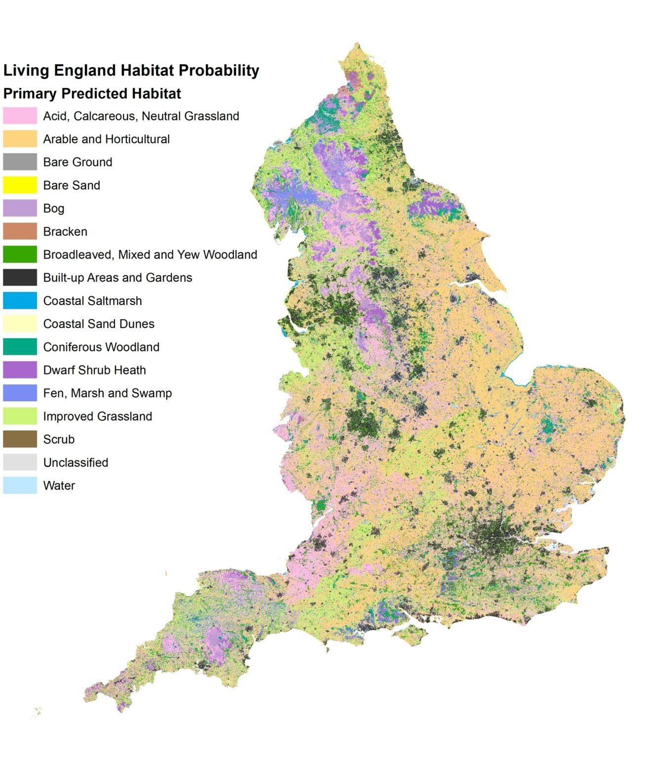
Living England Habitat Probability (Source: naturalengland.blog.gov.uk)
Habitat Mapping: Identify breeding grounds, wildlife corridors, and sensitive habitats such as wetlands or nesting dunes.
- Endangered Species: Flag and protect species listed under IUCN or national conservation frameworks.
- Vegetation Layers: Document native, endemic, and invasive plant species. Prioritize native species that support pollinators and require less maintenance.
The Convention on Biological Diversity (CBD, 2022) found that projects which integrate biodiversity data early in the design process reduce conflict and avoid costly ecological restoration later.
Expert Insight: Dr. Nalini Nadkarni, Forest Ecologist
“The flora and fauna are not decorative—they are foundational. Designing around them, not over them, leads to more resilient and enchanting spaces.”
Integrating GIS Tools and Satellite Data
Advanced tools like Geographic Information Systems (GIS), remote sensing, and drone imagery provide a data-driven foundation for landscape design:
- GIS Mapping: Allows for overlaying layers such as soil types, water flow, slope, vegetation density, and land use. This helps identify suitable zones for development and conservation.
- LiDAR & Satellite Data: Capture high-resolution 3D models of the terrain, enabling planners to track erosion, hydrology, and tree canopy changes over time.
- Predictive Modeling: Tools like coastal vulnerability indices and sea-level rise simulations can inform long-term viability.
NASA’s SERVIR initiative offers free climate and coastal monitoring tools, helping resorts in Southeast Asia track mangrove health and sea-level rise (NASA, 2023).
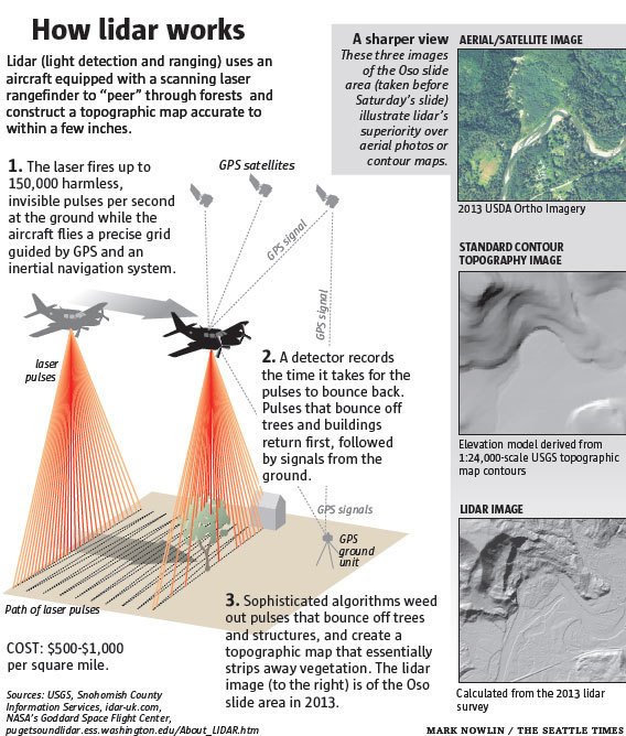
LiDAR (Source: special.seattletimes.com)
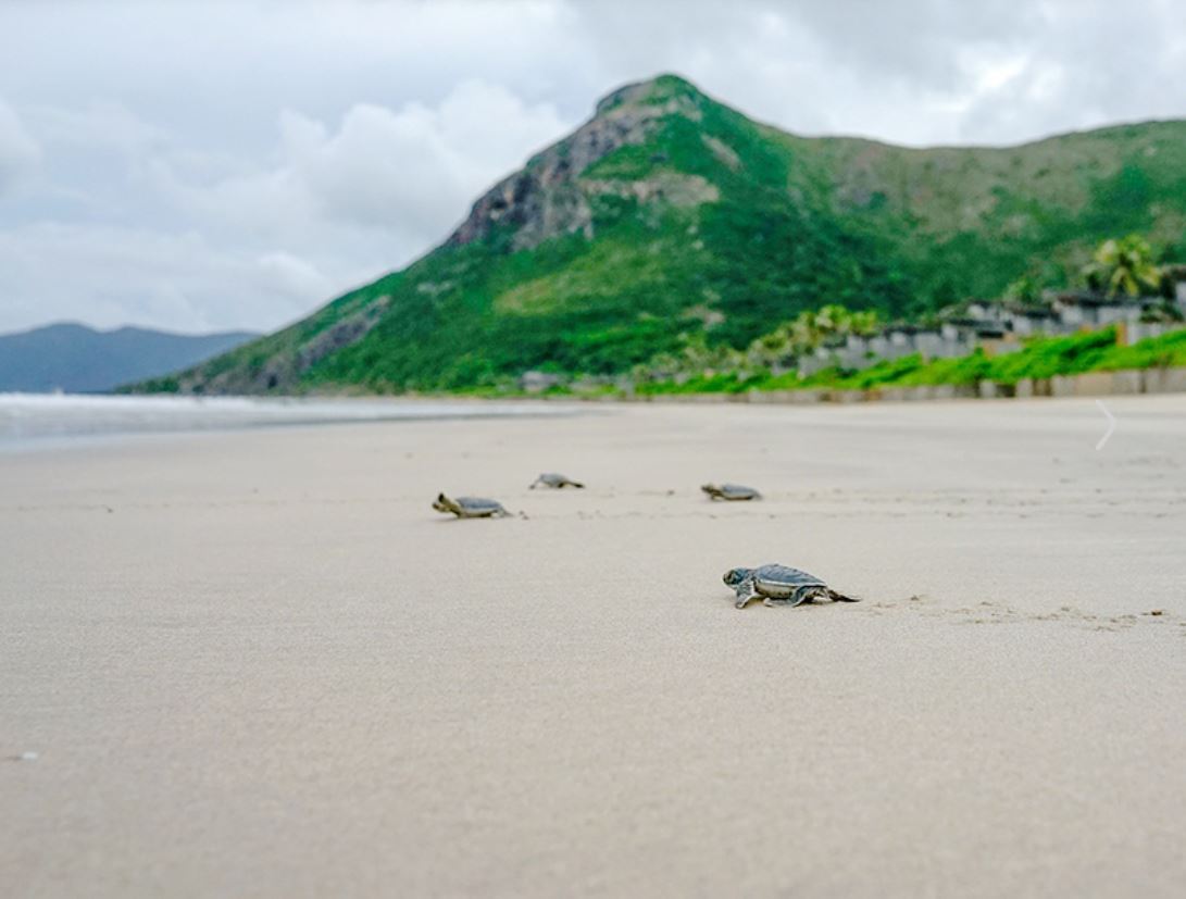
Case Study: Six Senses Con Dao, Vietnam - A model of Sustainable Coastal Design
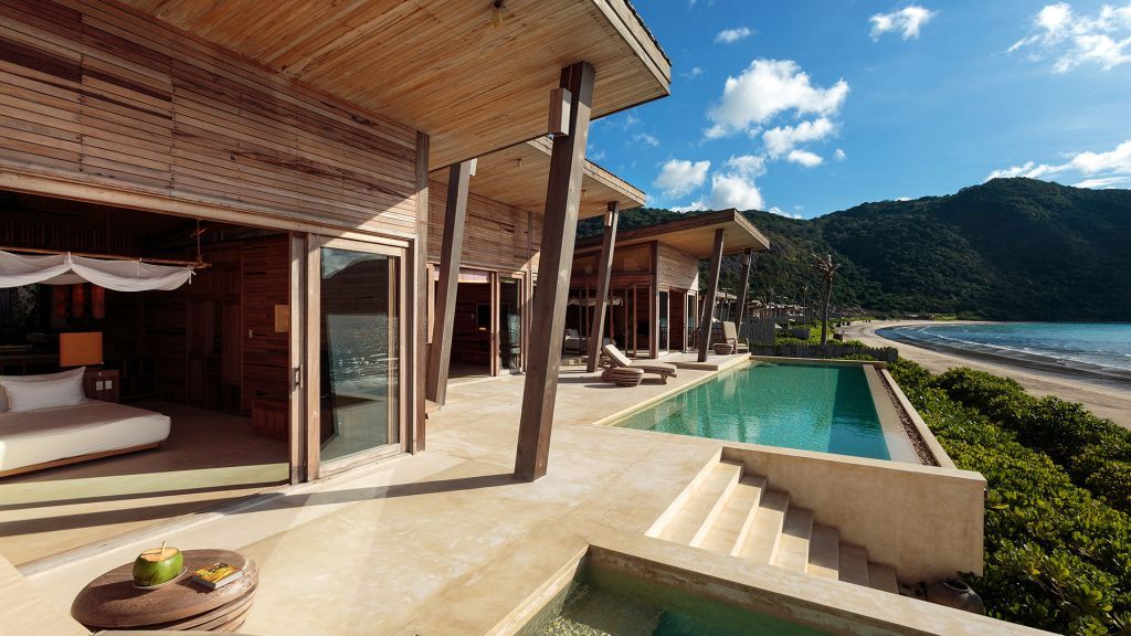
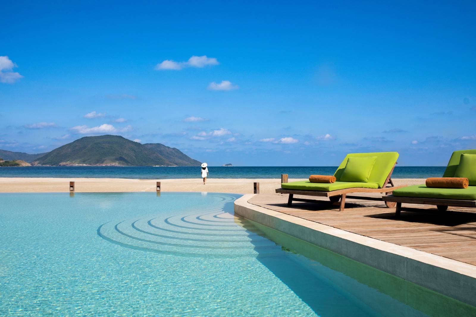
Six Senses Con Dao is a standout example of data-led, low-impact development and it demonstrates that advanced ecological mapping tools not only protect the environment but create a more immersive and memorable guest experience.
Location:
Dat Doc Beach, Con Dao Town, Con Dao District, Ba Ria – Vung Tau Province, Vietnam
Situated within a protected national and marine park, Six Senses Con Dao offers a secluded and pristine environment that harmoniously blends luxury with nature
Eco-Features:
-
Sustainable Architecture: The resort's design resembles a traditional Vietnamese fishing village, utilizing reclaimed teakwood and sustainable materials. Villas are constructed with natural ventilation systems, reducing the need for air conditioning.
-
Marine Conservation: In collaboration with Con Dao National Park authorities, the resort has restored its beach to support endangered green sea turtle nesting. Since 2018, over 26,000 hatchlings have been successfully released.
-
Waste Reduction: An on-site reverse osmosis plant provides remineralized drinking water in reusable glass bottles, eliminating the use of approximately 10,000 plastic bottles per month.
-
Organic Gardening: The resort maintains an extensive organic garden, producing over 30 types of plants, including fruits, vegetables, and herbs. Composting kitchen bio-waste enhances soil fertility, and treated wastewater irrigates the garden.
-
Community Engagement: Six Senses Con Dao runs environmental workshops for local schools and offers English classes to local children, fostering community development and environmental awareness.
-
Dune Preservation: The resort layout was shaped by digital terrain modeling, allowing it to fit between existing dunes rather than grading or flattening them.
-
Vegetation Protection: Construction avoided clear-cutting by mapping tree clusters and using GIS to plan buildings around them. Elevated walkways ensure root systems are not compacted.
-
Coral Protection: Guests are educated about reef-safe behaviors, and the resort funds coral reef surveys to monitor ecosystem health over time.

Nightly Rate:
Rates start from approximately $750 USD per night, varying based on villa type and season.
Website:
https://www.sixsensescondao.com/
Why It Matters
Ecological mapping isn’t just a planning tool—it’s a design philosophy. Understanding the site before shaping it allows developers to reduce risk, enhance biodiversity, and create destinations that are both sustainable and stunning.
Expert Insight: Kongjian Yu, Landscape Architect and Ecologist
“To heal the coast, we must first listen to it. Mapping is how we understand its language.”