1. Bo01 – City of Tomorrow
Bo01 City of Tomorrow, Malmö, Sweden - Source: Sébastien Ludwig_urbangreenbluegrids.com
Location: Western Harbour (Västra Hamnen), Malmö, Sweden
Firm: Malmö City Planning Office, in collaboration with various architectural and engineering firms including White Arkitekter and SWECO
Type: Urban Regeneration / Eco-District / Coastal Development
Website: https://malmo.se
Overview
Bo01—also known as “City of Tomorrow”—was developed as the flagship project for the European Housing Expo in 2001. Set on a former brownfield industrial site in Malmö’s Western Harbour, this district was transformed into a dense, walkable, and environmentally advanced urban neighbourhood. Bo01 is globally recognized as one of the earliest real-world examples of a sustainable, climate-responsive urban waterfront, integrating renewable energy systems, green infrastructure, and architectural innovation to promote a high quality of life in balance with ecological constraints.
Built on land once occupied by a shipyard and industrial port, Bo01 is part of Malmö’s broader shift from an industrial city to a green knowledge economy hub. The district serves as both a liveable community and a showcase for circular, integrated design.
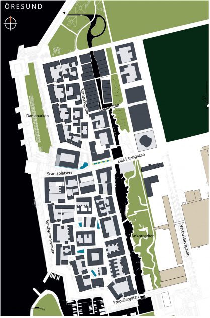
Masterplan Western harbour Bo01, Malmö - Source: Jonathan Perrin_urbangreenbluegrids.com
Eco-Features
-
100% Renewable Energy Supply: Bo01 is powered entirely by locally sourced renewable energy, including wind turbines, photovoltaic panels, solar thermal collectors, and biogas from organic waste.
-
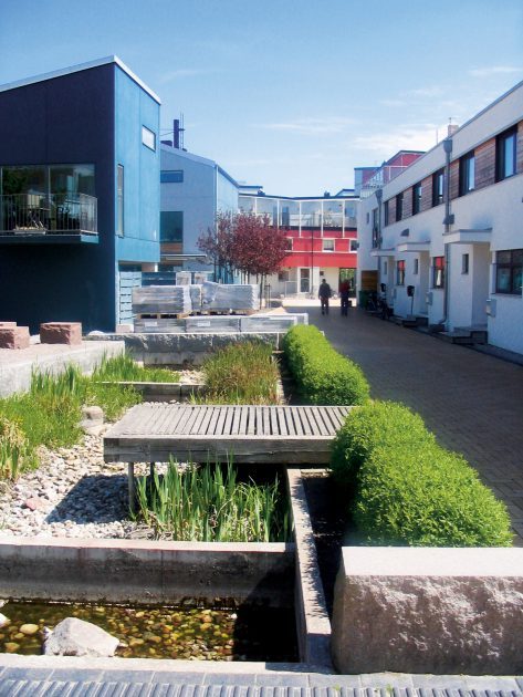
Stormwater Management: A “visible stormwater” system channels rain through open canals, swales, and retention ponds that cleanse and delay water discharge—enhancing biodiversity while reducing flood risks.
-
Biodiversity Planning: Habitat corridors and green roofs foster pollinator health and urban biodiversity; over 50% of plant species used are native.
-
Compact Urban Form: Mixed-use blocks are organized around pedestrian alleys, pocket parks, and canal fronts to reduce car dependency and foster community interaction.
-
Energy Efficiency Standards: Buildings meet or exceed Passive House energy requirements, with triple glazing, thermal massing, and natural ventilation systems.
Source: Sébastien Ludwig_urbangreenbluegrids.com
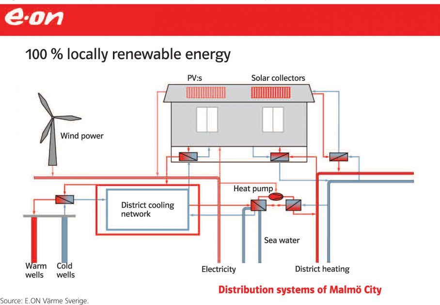
Malmö City distribution system 100 per cent local renewable energy - Source: E.ON Värme Sverige_urbangreenbluegrids.com
Ocean Conservation and Community Resilience Initiatives
Although not strictly an ocean conservation project, Bo01’s proximity to the Öresund Strait and its integration of blue-green infrastructure highlight important connections to marine ecosystems:
-
Coastal Ecosystem Integration: The restored shoreline and nearby Turning Torso Park provide habitat connectivity and protect against coastal erosion.
-
Wastewater and Nutrient Recycling: Bo01 promotes closed-loop systems that minimize marine pollution, such as separating stormwater from sewage and using greywater in irrigation.
-
Educational Features: Interpretive signage and design transparency invite residents and visitors to learn about water cycles, energy systems, and ecological processes.
-
Access to Nature: Direct public access to the water promotes marine awareness, sustainable recreation, and a strong sense of place tied to coastal identity.
Key Achievements
-
Global Model: Bo01 has been widely studied by planners, architects, and policymakers worldwide and remains a model for sustainable urban waterfronts.
-
Carbon-Neutral District: It was one of the world’s first developments designed to be 100% powered by renewables.
-
Increased Property Values and Liveability: The success of Bo01 led to high demand for housing, prompting Malmö to expand similar principles across the entire Western Harbour.
-
Ecosystem Services Valuation: The integration of water, vegetation, and community spaces has been credited with improving local air quality, biodiversity, and wellbeing.
Role of Landscape Architecture
Landscape architecture played a central role in Bo01’s design philosophy. Planners and landscape architects envisioned an urban fabric where ecology, infrastructure, and daily life are inseparably linked. The visible stormwater network and green corridors aren’t decorative—they are functional, performative elements that educate and empower residents.
The urban landscape integrates water features into courtyards, canals, and walkways, helping to reframe how infrastructure can be both ecological and aesthetic. The design team created a hierarchy of green spaces, from intimate courtyards to coastal wetlands, that reinforce a sense of place while delivering resilience.
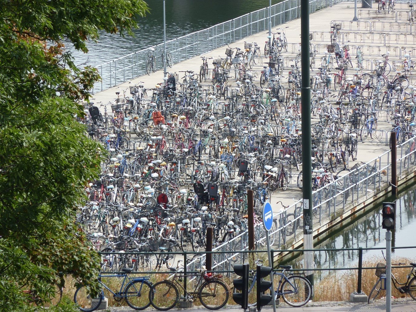
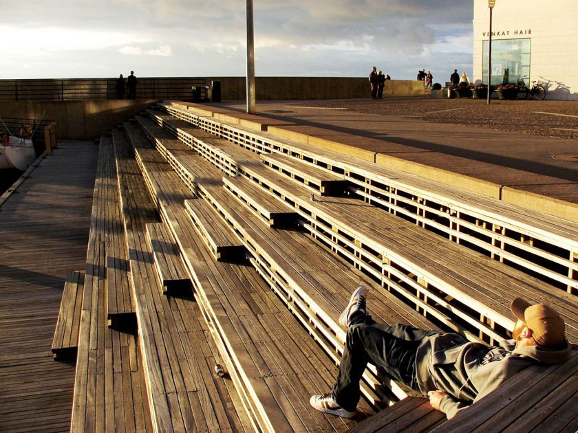
Cycling in Malmö - Source: Françoise Labbé_neighbourhoodguidelines.org
Learn More / References
-
Malmö Stad Official Website: https://malmo.se
-
Beatley, T. (2011). Biophilic Cities: Integrating Nature into Urban Design and Planning.
-
European Commission (2013). Smart Cities: Malmö Case Study.
-
White Arkitekter: https://whitearkitekter.com
-
UN-Habitat. (2012). Malmö’s Bo01: A Showcase of Sustainable Urban Development.
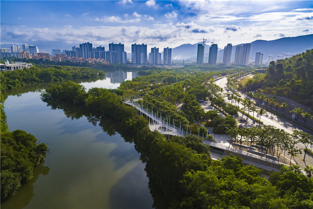
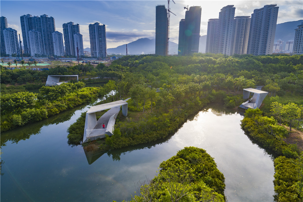
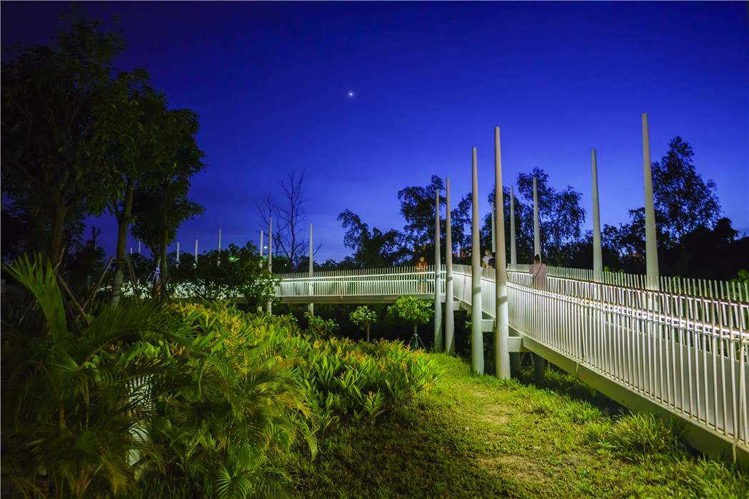
2. Sanya Mangrove Park – Turenscape
Location: Sanya River, Hainan Island, China
Firm: Turenscape (Principal: Kongjian Yu)
Type: Urban Ecological Waterfront / Coastal Green Infrastructure
Website: https://www.turenscape.com
Overview
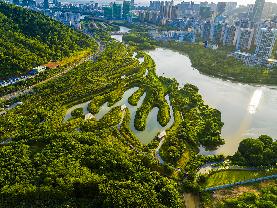
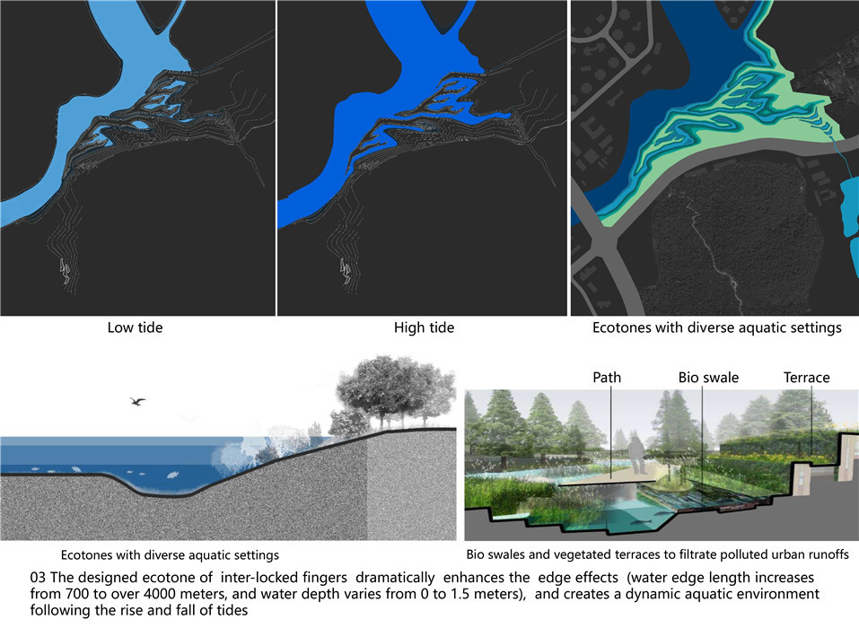
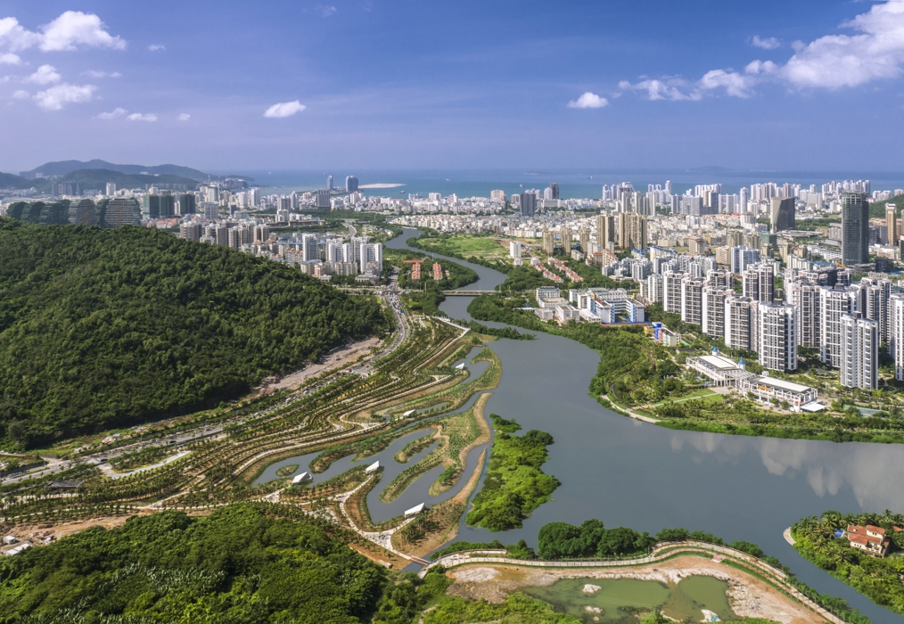
Sanya Mangrove Park is an exemplary urban ecological restoration project that reclaims a degraded riverfront in the tropical city of Sanya, located on the southern tip of China’s Hainan Island. Once an ecologically critical estuary mangrove ecosystem, the site had suffered from pollution, encroachment, and channelization. Turenscape's intervention reimagines the area as a multifunctional urban park, blending ecological restoration with public amenity and flood protection.
Rather than resisting nature, the design embraces tidal dynamics, sediment movement, and wetland regeneration. The park is part of Turenscape’s broader “sponge city” strategy, promoting resilient urbanism through ecological infrastructure that works with water rather than against it.
Eco-Features
-
Mangrove Restoration: The park reintroduces native mangrove species and rehabilitates degraded tidal wetlands, creating a rich estuarine ecosystem that supports migratory birds, fish, and crabs.
-
Flood Resilience: Designed as a floodable landscape, the park accommodates seasonal flooding and tidal surges, acting as a living buffer that protects adjacent neighbourhoods.
-
Wetland Terraces: Gently graded terraces stabilize sediments, reduce erosion, and serve as zones for different plant communities adapted to brackish conditions.
-
Natural Water Filtration: Vegetated bio-swales and wetlands help cleanse polluted runoff from the urban watershed before it reaches the river and ocean.
-
Boardwalks and Viewing Platforms: Elevated walkways provide immersive access to nature while protecting sensitive wetland zones from trampling and disturbance.
Ocean Conservation and Community Resilience Initiatives
-
Ecosystem Services: The restored mangrove forests enhance fish nursery habitats, protect against coastal erosion, and sequester large amounts of carbon, contributing to local and global ecological health.
-
Biodiversity Corridors: By reconnecting fragmented habitats, the park supports migratory bird routes along the East Asian–Australasian Flyway.
-
Community Education: Interpretive signage and educational zones within the park raise awareness about mangrove ecology, climate change adaptation, and marine biodiversity.
-
Equitable Access to Nature: The park provides free and inclusive public space in a rapidly urbanizing city, promoting health, cultural continuity, and environmental stewardship.
Key Achievements
-
International Recognition: The project has received accolades for ecological restoration and design excellence, including awards from the World Landscape Architecture community and ASLA.
-
Scalable Sponge City Model: Sanya Mangrove Park serves as a replicable model for other coastal cities facing similar challenges from sea level rise and ecological degradation.
-
Flood Reduction: Post-construction evaluations show significant improvement in urban water management and a reduction in flood risks to surrounding areas.
-
Public Support: The park is widely used and appreciated by local residents, becoming a symbol of green urban transformation in Sanya.
Role of Landscape Architecture
Sanya Mangrove Park exemplifies landscape architecture as an interdisciplinary practice that merges ecological science, civic design, and cultural meaning. Turenscape’s work prioritizes process over form, allowing the river and its ecosystems to guide the design rather than imposing rigid geometries.
Kongjian Yu’s philosophy of “Big Feet Revolution” is reflected here: using large-scale, ecological thinking to solve urban problems with nature-based solutions. The project transforms a neglected riverfront into a biodiverse, resilient, and socially inclusive landscape.
By working with tidal flows, restoring native vegetation, and creating public access without compromising conservation goals, landscape architecture demonstrates its power to mediate between people and the planet.
Learn More / References
-
Turenscape Project Page: Sanya Mangrove Park
-
Kongjian Yu. (2020). Designed Ecologies: The Landscape Architecture of Kongjian Yu (Birkhäuser)
-
ASLA Professional Awards Archive
-
IFLA World Congress Presentations – Nature-Based Solutions in Coastal Cities
-
"Ecological Urbanism in China" – Harvard GSD Case Study
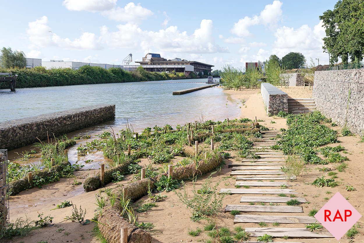
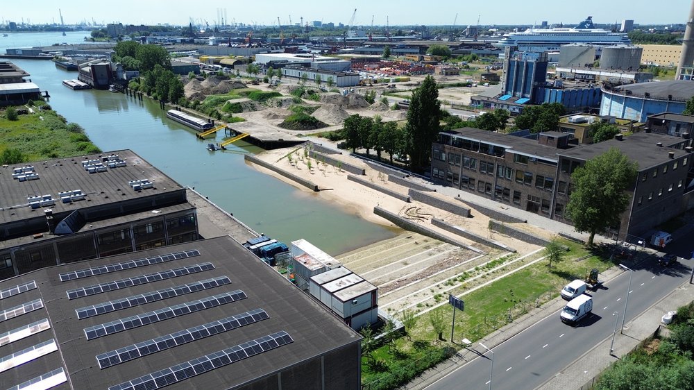
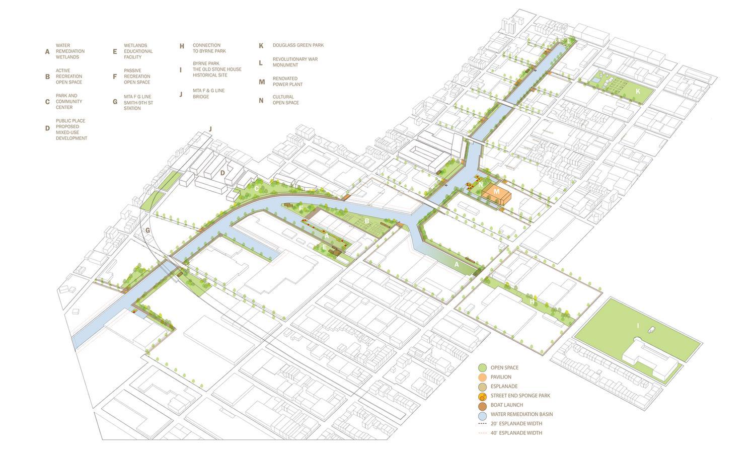
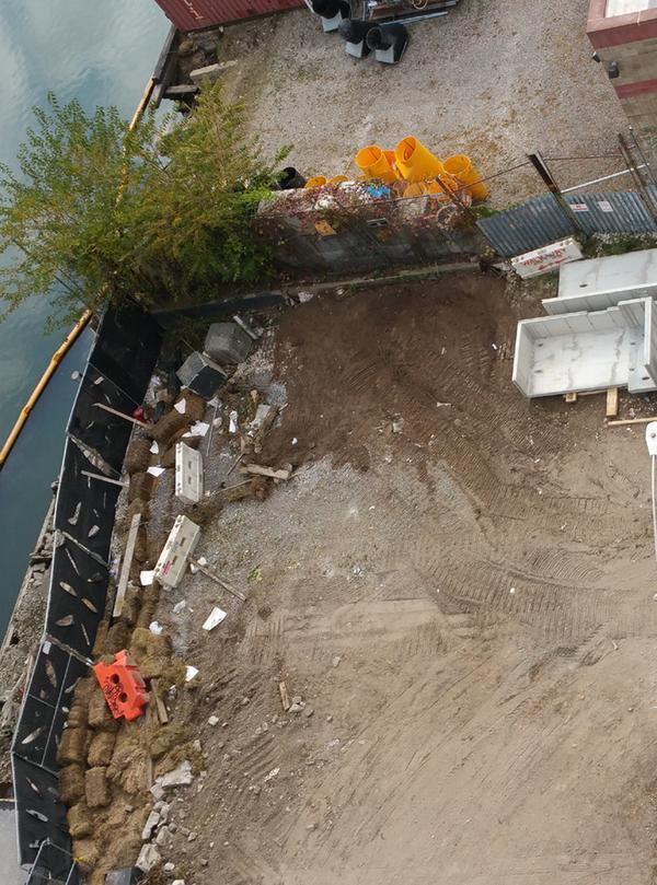
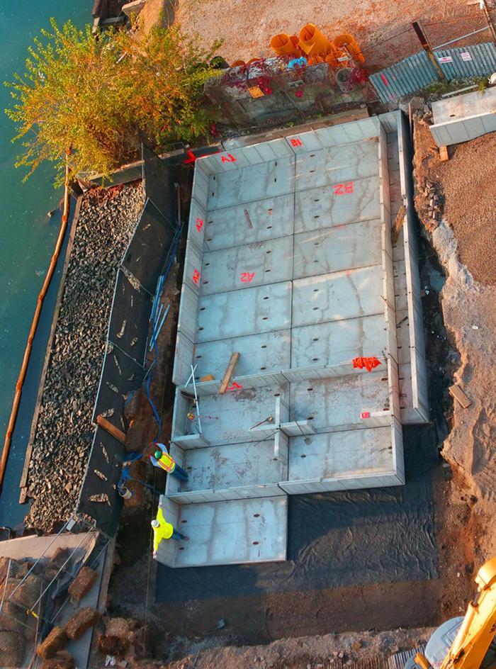
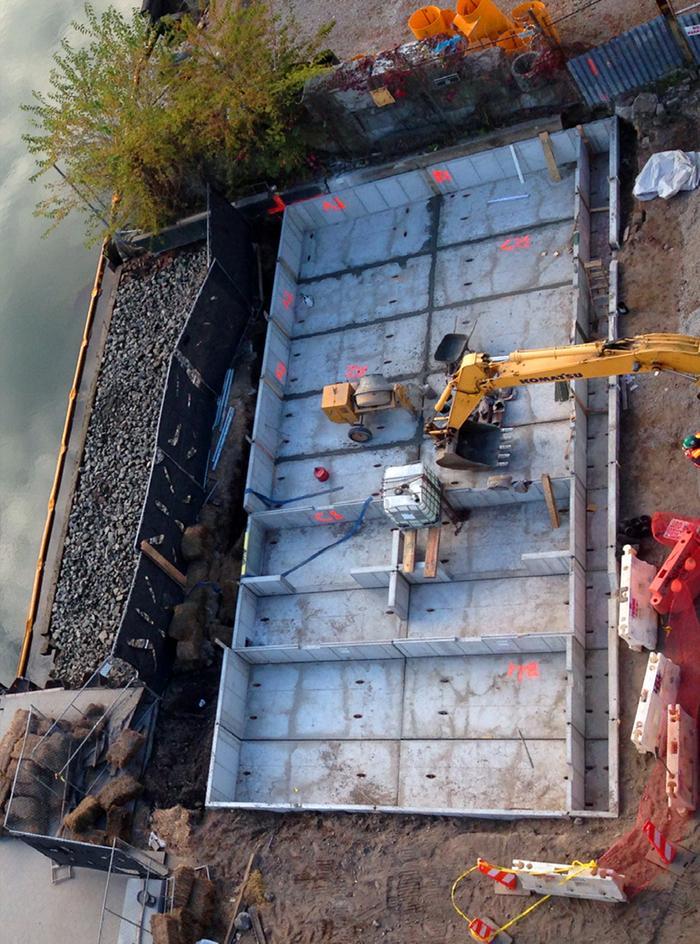
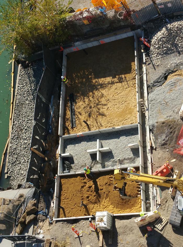
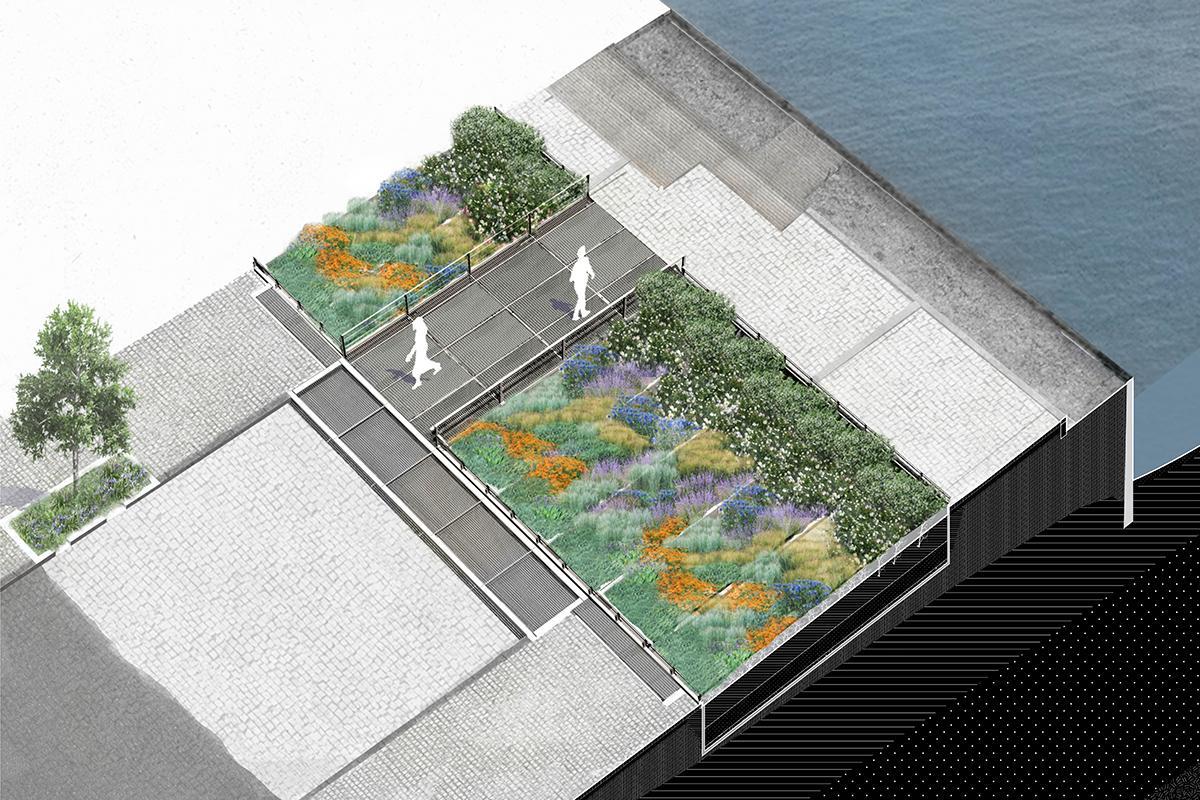
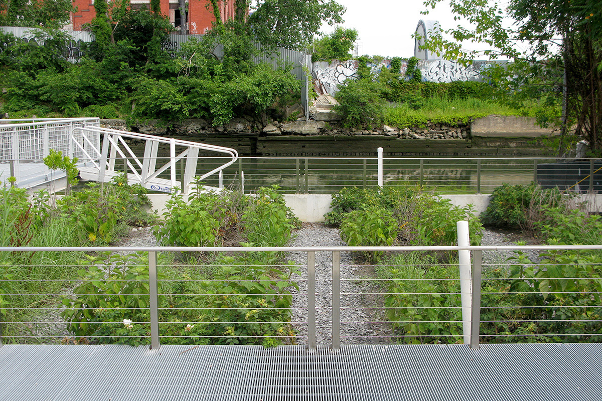
3. Keilehaven Tidal Park – De Urbanisten
The tidal influence is an important factor that gives us dynamics within an urban area. This makes parts of the park accessible at low tide, but not at high water. This results in a dynamic public space with a chance of an exceptional experience of nature; an encounter with a kingfisher, dragonflies or cormorant that are drawn to the rich underwater life.
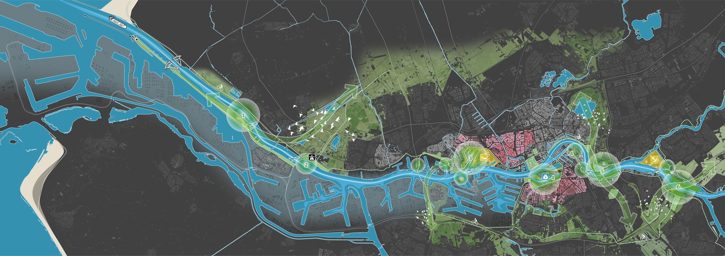
The river as a tidal park
Location: Rotterdam, The Netherlands
Firm: De Urbanisten (in collaboration with the City of Rotterdam)
Type: Urban Tidal Park / Climate Adaptive Infrastructure
Website: https://www.urbanisten.nl
Overview
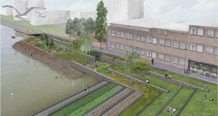
Keilehaven Tidal Park is a pioneering urban intervention transforming a disused harbour basin in Rotterdam into a climate-adaptive tidal landscape that functions as both a resilient ecological system and an accessible public realm. Located in the M4H (Merwe-Vierhavens) innovation district, the project integrates urban redevelopment, nature restoration, and water resilience into a bold vision for future-facing cities.
De Urbanisten, a landscape and urbanism studio known for its imaginative and process-based work, proposed a “living edge” where the dynamics of the Nieuwe Maas River are allowed to reshape the site. Rather than fighting the daily tidal fluctuations, the park embraces them—restoring estuarine habitat while delivering flood defence, water purification, and community engagement.
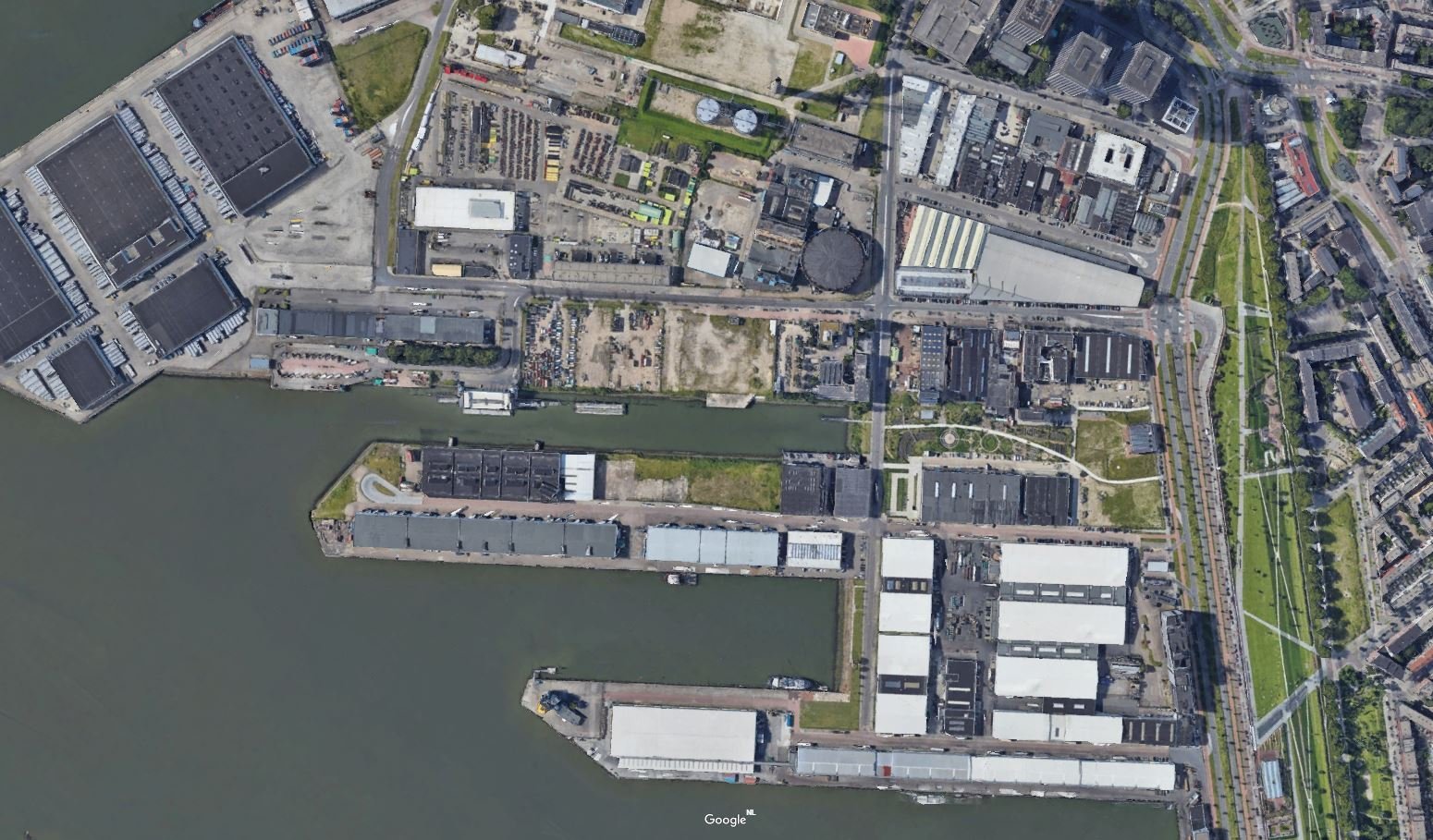
Location Keilehaven
Eco-Features
-
Tidal Wetlands: Native estuarine vegetation—such as reeds, sedges, and halophytes—have been planted to form intertidal habitats, offering food and shelter for fish, birds, and invertebrates.
-
Soft Shorelines: Concrete quays have been partially removed or cut back to allow for “soft edges,” enabling the river to flow in and out with the tides, regenerating natural sedimentation and soil conditions.
-
Floating Platforms: Modular floating wetlands and pontoon-like structures accommodate vegetation and wildlife while allowing people to engage with the water in safe, controlled ways.
-
Sediment Catchment: The design incorporates silt traps and biofilters that slow water and trap pollutants, contributing to water quality improvement in the harbour.
-
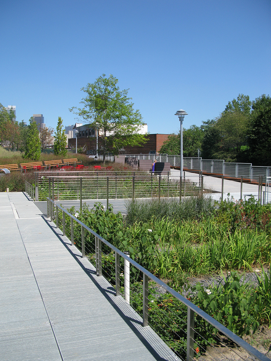
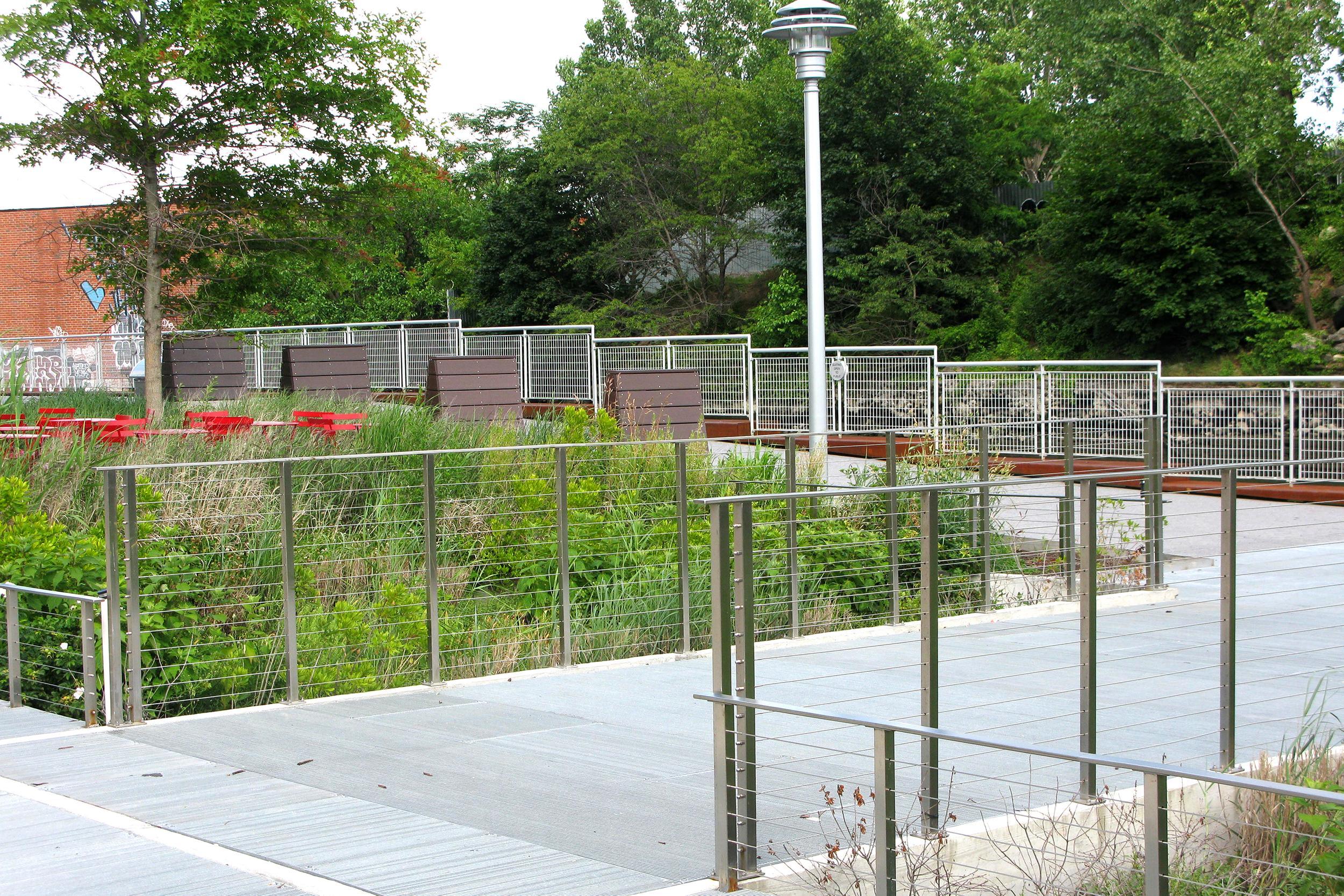
Public Access: Elevated walkways and stepped terraces provide access to the tidal park during different water levels, making tidal dynamics a visible and educational part of urban life.
Ocean Conservation and Community Resilience Initiatives
-
Biodiversity Enhancement: The project revives lost brackish-water habitats in one of Europe’s busiest ports, supporting spawning fish, amphibians, and birds, and functioning as a stepping-stone habitat corridor in the Rijn-Maas delta.
-
Citizen Science & Education: Interpretation boards and citizen-led biodiversity monitoring programs help the public understand tidal cycles, estuarine ecology, and water quality issues.
-
Urban Cooling & Carbon Sequestration: Wetlands and shaded planting help mitigate urban heat island effects, while the organic soils sequester carbon, contributing to Rotterdam’s climate adaptation strategy.
-
Climate Buffer: The park acts as a flexible buffer zone, accommodating storm surges and sea level fluctuations while protecting inland areas and critical port infrastructure.
Tidal Park Keilehaven Low Tide
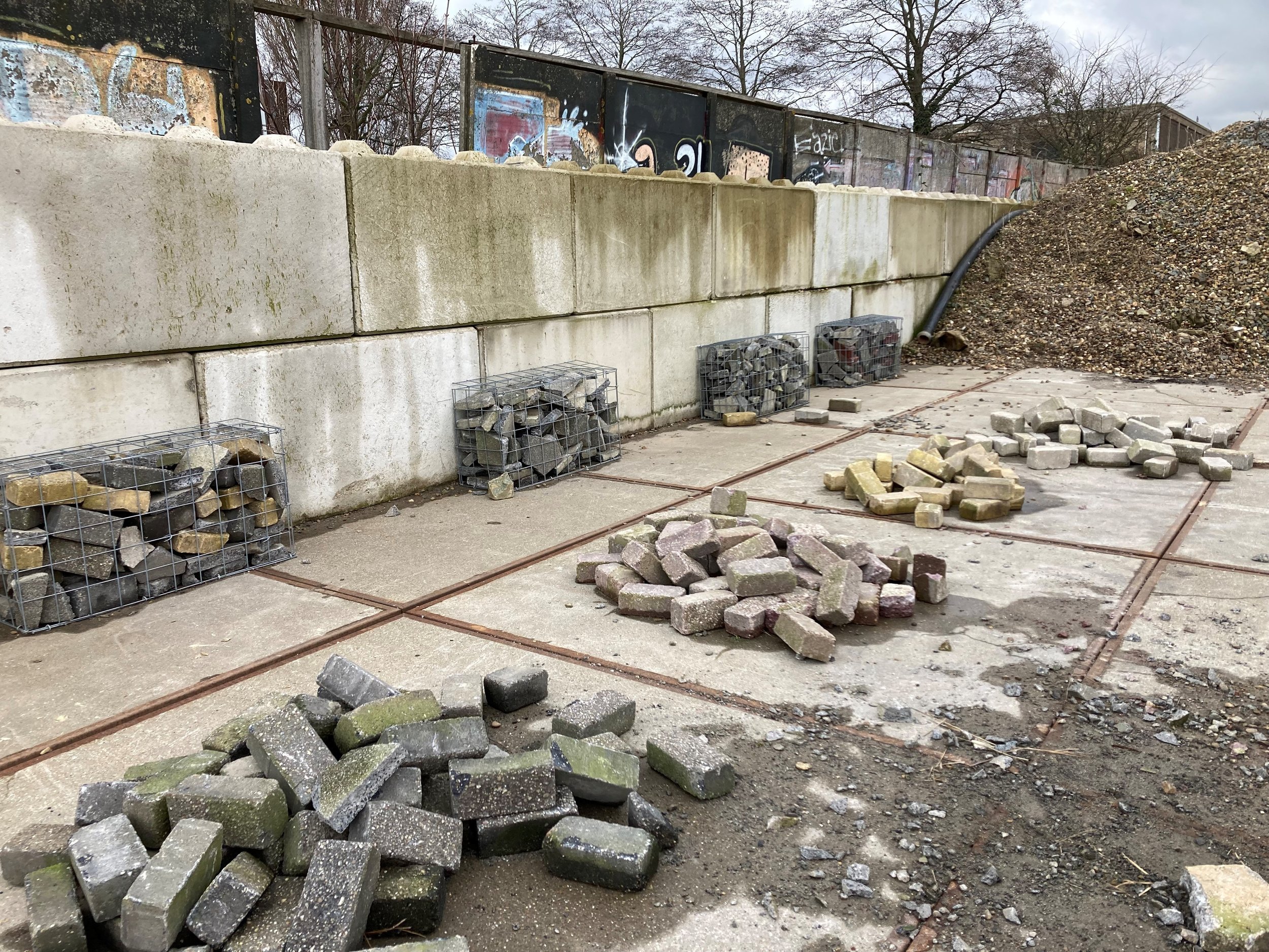
Over the past two years, construction work has taken place in and around the water of the Keilehaven. The harbor basin has been transformed from a rocky plain into a tidal park, a habitat for new ecosystems and a place where visitors can enjoy unique nature experiences thanks to daily change in low and high tide. The park is now open to visitors
Key Achievements
-
First Urban Tidal Park in Rotterdam: Keilehaven marks a significant shift in how Dutch port cities integrate ecological restoration with climate adaptation and waterfront regeneration.
-
Multi-Stakeholder Governance: The park was realized through a collaboration between the city government, port authority, local universities (e.g., Delft University of Technology), and environmental NGOs.
-
Innovation Showcase: The site is part of the Rotterdam Resilience Strategy and the EU-funded “Resilient Cities” knowledge-sharing platform.
-
Prototype for Circular Harbor Redevelopment: Keilehaven demonstrates how obsolete industrial waterfronts can be reimagined as spaces that generate ecological, cultural, and economic value simultaneously.
Role of Landscape Architecture
De Urbanisten used a systems-thinking approach to develop the Keilehaven Tidal Park—emphasizing not only form and aesthetics but also the site's ecological flows, tidal rhythm, and socio-cultural dimensions. The firm’s design restores the hydrological relationship between city and river, where natural and human systems are reconciled rather than isolated.
By framing the harbour as a landscape-in-process, they challenge traditional notions of static infrastructure and champion adaptive, resilient design. This is landscape architecture as interface—between land and water, ecology and infrastructure, memory and innovation.
Their layered design methodology—with landscape performance metrics, stakeholder input, and long-term ecological modelling—ensures the park is not just a green decoration but an evolving, functional ecosystem embedded in the city.
Learn More / References
-
Project Overview: De Urbanisten – Keilehaven Tidal Park
-
Rotterdam Resilience Strategy: https://resilientrotterdam.nl
-
Nature-based Solutions for Water in Urban Areas (EU Report, 2020)
-
Case Study in IFLA Europe 2022 Proceedings on “Coastal Adaptation and Landscape Planning”
4. Gowanus Canal Sponge Park – DLANDstudio
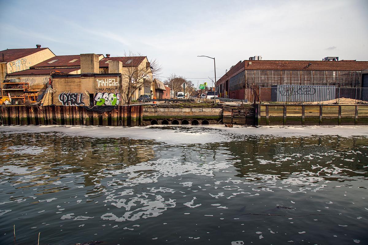
Currently, the Gowanus Canal and its surroundings are suffering from years of exposure to industrial waste and water pollution. This is compounded by New York City’s combined sewer system. During a storm event, rain falling within the Gowanus watershed enters storm drains and mixes with raw sewage in the sanitary sewer system. During heavy rainfalls the combined sewage and storm water overflow directly into the Gowanus Canal.
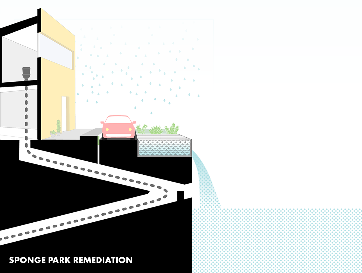
Sponge Park™ re-directs, holds, and treats storm water runoff to minimize the volume of overflows that occur within the canal, reducing raw sewage contamination and thus helping to clean the watershed.
Location: Brooklyn, New York, USA
Firm: DLANDstudio Architecture + Landscape Architecture
Type: Urban Green Infrastructure / Water Management Landscape
Website: https://www.dlandstudio.com
Overview
The Gowanus Canal Sponge Park is an innovative urban design and landscape infrastructure project developed to remediate one of the most polluted waterways in the United States: the Gowanus Canal in Brooklyn, New York. Spearheaded by Susannah Drake of DLANDstudio, the Sponge Park is not a conventional park—it is a working landscape that captures and cleans stormwater before it enters the canal, thereby reducing the impact of combined sewer overflows (CSOs), improving water quality, and reclaiming public space for community use.
Initially conceived as a research and demonstration project, Sponge Park integrates ecological restoration, public open space, and urban water management into a flexible and scalable model. It aligns with New York City’s long-term sustainability vision and provides a replicable approach to climate resilience in dense urban environments.
A strategy of urban stitching is proposed to connect the public and private lands adjacent to the water and create a continuous esplanade running the length of the canal. Underpinning the strategy are a series of waterfront spaces known as the Sponge Park™, designed as a working landscape that improves water quality and activates the canal edge while communicating a larger vision for stewardship of the environment to a community with many competing voices, agendas and concerns.
Eco-Features
-
Bioswales and Biofiltration Basins: Carefully engineered soils and plantings filter stormwater runoff, removing pollutants such as heavy metals, oil, and bacteria before the water reaches the canal.
-
Wetland Plant Communities: Native plants like switchgrass (Panicum virgatum), sedges, and rushes are used to support habitat creation and filter stormwater naturally.
-
Porous Pavements: Paving materials that allow water infiltration reduce runoff volume and prevent water from overwhelming sewer systems.
-
Floating Wetlands: Piloted adjacent to the canal, these modules host vegetation while aiding in water filtration and providing habitat for aquatic life.
-
Modular Design: The project’s scalable, prefabricated modules allow for phased implementation and adaptation to other urban sites with similar CSO issues.
Ocean Conservation and Community Resilience Initiatives
-
Stormwater Pollution Reduction: The system captures the first inch of stormwater—the most polluted—thereby intercepting up to 6 million gallons annually before it reaches the canal.
-
Ecological Remediation: While not directly in the ocean, this project supports larger marine ecosystem health by reducing the pollutants entering New York Harbor.
-
Community Engagement: The Sponge Park doubles as an educational landscape, with interpretive signage and active programming that teaches residents about water systems and climate change.
-
Green Job Creation: Maintenance and monitoring of the Sponge Park contribute to the local green economy through urban ecology and infrastructure stewardship roles.
Key Achievements
-
Award-Winning Prototype: The project has received numerous accolades, including from the NYC Public Design Commission and the American Society of Landscape Architects (ASLA), for its integration of aesthetics, engineering, and ecological performance.
-
Public-Private Partnership: Funded by a mix of NYC Department of Environmental Protection (DEP), NY State Environmental Facilities Corporation, and private donors.
-
EPA Brownfield Grant Pilot Site: The park served as a key testbed for urban green infrastructure in brownfield redevelopment contexts.
-
Influence on Policy: Sponge Park has informed broader NYC DEP and PlaNYC strategies on decentralized stormwater infrastructure and the green-blue corridor concept.
Role of Landscape Architecture
DLANDstudio pioneered the integration of engineered ecology with civic space through this project. The firm’s hybridized approach—merging design, infrastructure, and scientific modelling—positioned the Sponge Park as an icon in the field of landscape infrastructure.
Rather than “decorating” the canal’s edge, DLANDstudio used landscape as infrastructure: a living system that intercepts pollution, absorbs tidal energy, and reconnects fragmented urban fabric. Their work demonstrates how landscape architects can lead multidisciplinary efforts to transform legacy industrial sites into living, breathing urban ecologies.
Moreover, DLANDstudio’s research-driven design process—combining hydrology models, community input, and iterative prototyping—sets a precedent for how landscape architecture can catalyze environmental justice, urban resilience, and systemic change.
Learn More / References
-
DLANDstudio Sponge Park: https://www.dlandstudio.com/gowanus-canal-sponge-park
-
NYC DEP Green Infrastructure Program: https://www.nyc.gov/html/dep/html/stormwater/green_infrastructure.shtml
-
EPA Gowanus Canal Superfund Site Overview: https://www.epa.gov/superfund/gowanus-canal
-
ASLA Award (2010): https://www.asla.org/2010awards/163.html
Featured Posts
Blog Topics
Urban environment & Public spaces
Stay updated with the latest articles and insights from The Landscape Lab. Here, you will find valuable information and engaging content.
Waterfront & Coastal Resilience
Stay updated with the latest articles and insights from The Landscape Lab. Here, you will find valuable information and engaging content.
Captivating Photography
Stay updated with the latest articles and insights from The Landscape Lab. Here, you will find valuable information and engaging content.
Why Read The Landscape Lab Blog?
The way we design and interact with landscapes is more important than ever. As cities expand, coastlines shift, and climate change reshapes our world, the choices we make about land, water, and urban spaces have lasting impacts. The Landscape Lab Blog is here to spark fresh conversations, challenge conventional thinking, and inspire new approaches to sustainable and resilient design.
If you’re a landscape architect, urban planner, environmentalist, or simply someone who cares about how our surroundings shape our lives, this blog offers insights that matter. We explore the intersections between nature and the built environment, diving into real-world examples of cities adapting to rising sea levels, innovative waterfront designs, and the revival of native ecosystems. We look at how landscapes can work with nature rather than against it, ensuring long-term sustainability and biodiversity.
By reading The Landscape Lab, you'll gain a deeper understanding of the evolving field of landscape design—from rewilding initiatives to regenerative urban planning. Whether it’s uncovering the forgotten history of resilient landscapes, analyzing groundbreaking projects, or discussing the future of green infrastructure, this blog provides a space for learning, inspiration, and meaningful dialogue.
Location:
The Landscape Lab
123 Greenway Drive
Garden City
NY 12345
United Kingdom
Contact Number:
Get in Touch:
contact@thelandscapelab.co.uk
© 2025 thelandscapelab.co.uk - Your go-to blog for landscaping insights